-320x240.gif?disposition=inline)
Multimedia
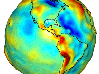
Total water storage from GRACE, 2007

This image shows the mean annual amplitude of total water storage on Earth in 2007 as measured by GRACE.
This image shows the mean annual amplitude of total water storage on Earth in 2007 as measured by GRACE.
