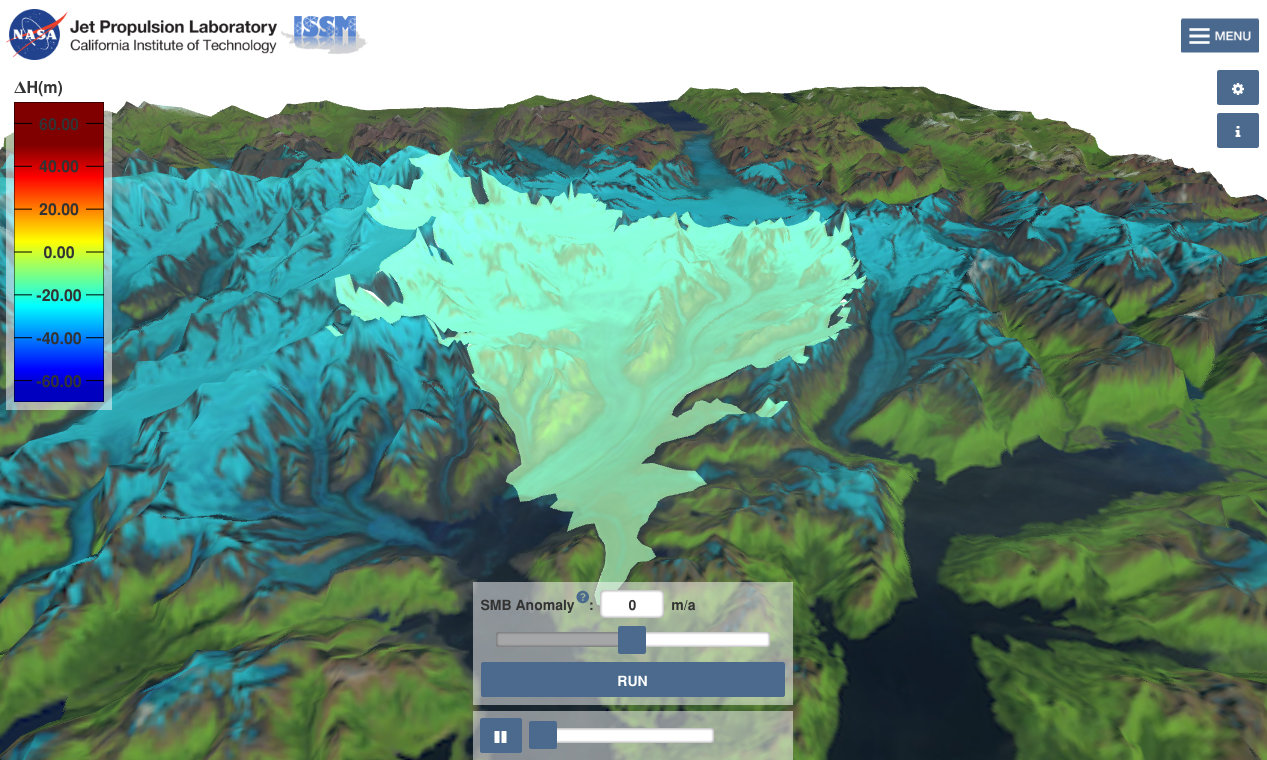
The Virtual Earth System Laboratory includes simulations related to glaciers, ice sheets, sea level and solid earth.
Understanding Sea Level
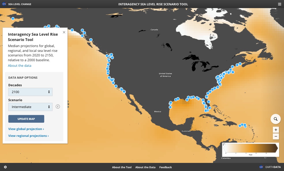
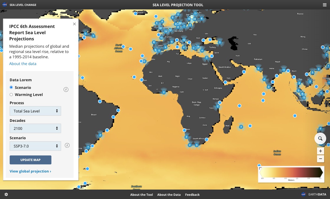
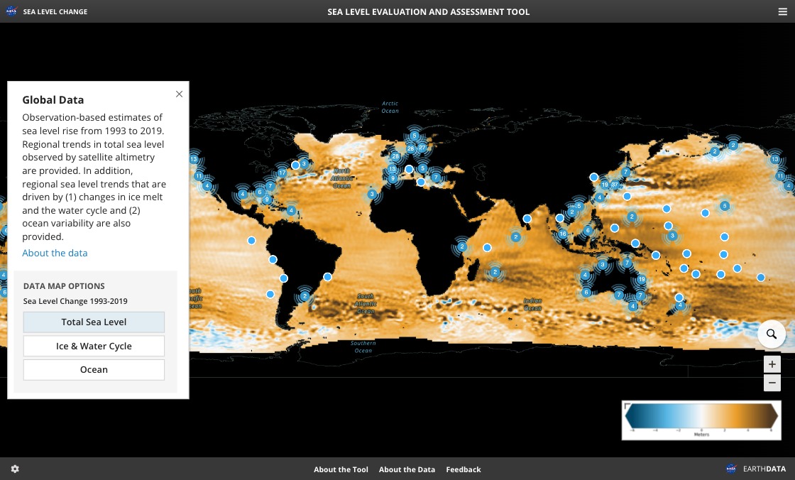
NASA keeps track of sea level change and its causes from space. Find out more about how NASA satellite observations help our understanding of this complex topic.
NASA keeps track of sea level change and its causes from space. Find out more about how NASA satellite observations help our understanding of this complex topic.
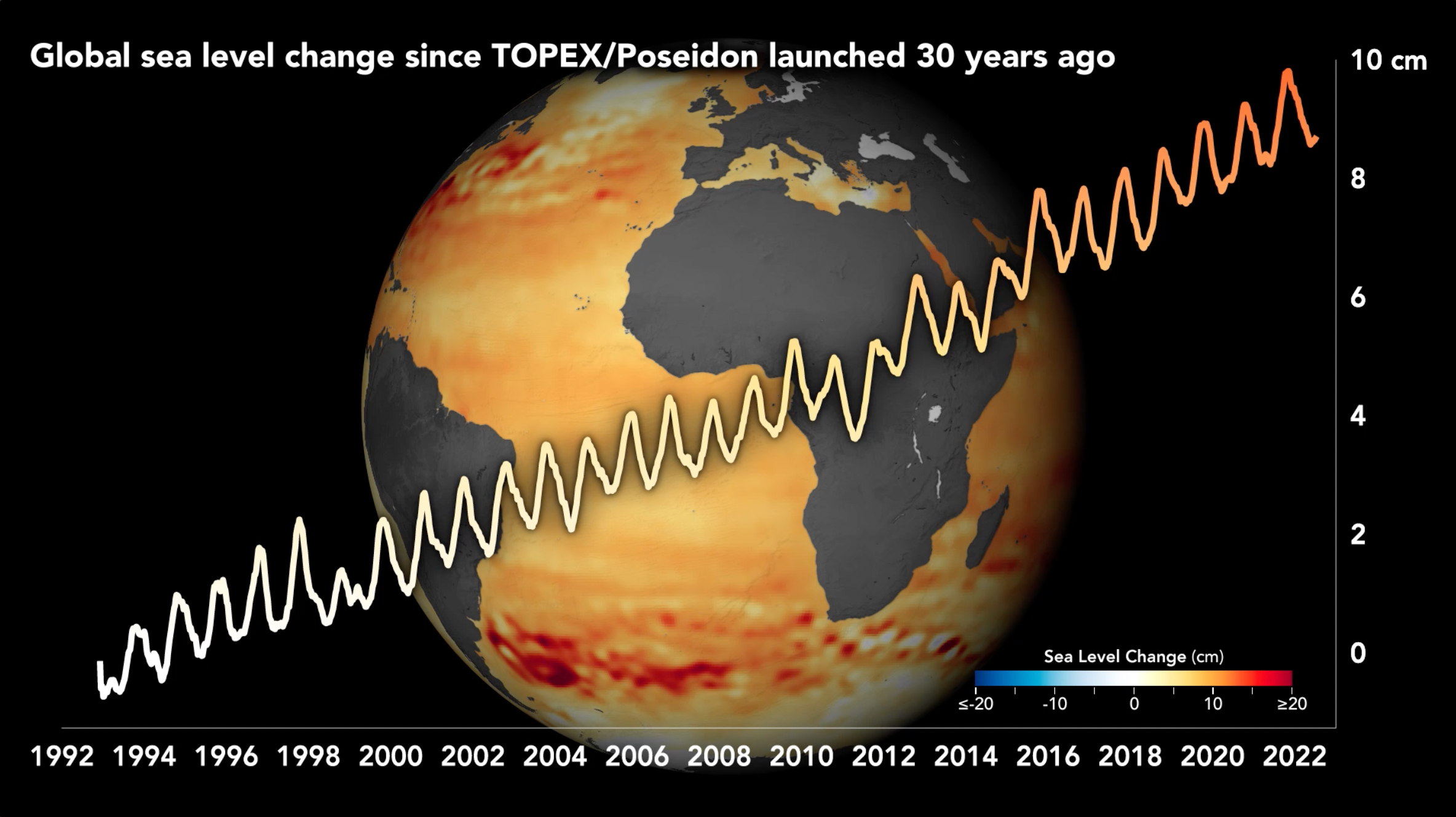
Global Sea Level
Explore the main causes: ice melt and heat-driven expansion of ocean water