News | June 12, 2017
Looking back, and looking forward: a NASA career in glaciology
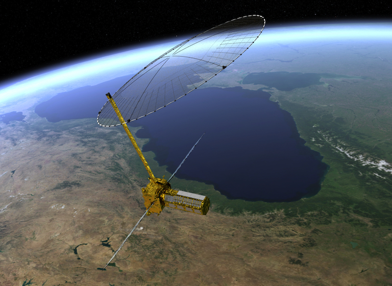
Artist's rendering of the NISAR satellite. Image credit: NASA/JPL.
He waited to fly the mission for decades. And now it was finally happening.
Eric Rignot lingered in a hallway at NASA’s Jet Propulsion Laboratory in Pasadena, answering a few questions about his long, high profile career. He was there for a Science Team meeting on NISAR (NASA-ISRO Synthetic Aperture Radar), a satellite mission expected to launch in 2020.
A collaboration of NASA and the Indian Space Research Organization, NISAR is expected to score a first: complete coverage of the entire planet’s ice sheets, glaciers and ice caps every 12 days.
Rignot began his career at JPL in the late 1980s, working on an early version of NISAR’s key instrument, the synthetic-aperture radar, which combines radar beams for high-precision mapping. In the years that followed, he became a well-known glaciologist, familiar to the public on television documentaries and in newspaper and magazine interviews.
His research in the Arctic and Antarctic revealed rapidly melting glaciers, one of the most visible effects of a warming planet.
NISAR, Rignot said, should help answer stubborn questions about how fast the polar regions are losing ice mass, and how soon the effects will be felt in the world’s coastal regions.
Does this science team meeting represent a major milestone for NISAR?
When I started my career at JPL, with Charles (Elachi), I was at the right time at the right place for launching the EOS SAR instrument. Unfortunately, we never flew EOS SAR. The plan was to free fly (the radar instrument) in the early 1990s. But it’s only going up now, in 2020. I spent my whole career waiting for this. It’s always been in the back of my mind, doing this work, wanting to fly this mission. Now it’s happening after all these years.
What are some of the gaps in knowledge that future missions will help to fill?
Besides the need to have a continuous, comprehensive coverage of ice dynamics in the polar regions with NISAR, there are still two big missing elements. One is ice thickness/bed topography and the other is ocean temperature. We’ve made a lot of progress in Greenland with OMG (NASA’s Oceans Melting Greenland survey focusing on glaciers and fjords) along these lines. Now we’ve completed the mapping of the bed topography beneath the ice sheet and the bathymetry of surrounding ocean in a seamless fashion, with high quality data.
We have to do something similar in Antarctica. But it’s seven times bigger and a lot more complex.
We still have some parts of Antarctica that have not been surveyed in any detail – for instance, between the Marie Byrd Land sector in West Antarctica and the Wilkes Land sector of East Antarctica. They’re difficult for us to reach for IceBridge (NASA’s aircraft overflight mission). East Antarctica is especially important. The Wilkes Land sector is its most vulnerable part, and yet there is a lot of detailed information about the ocean properties and the bed topography that is needed to understand its evolution.
Do you expect to catch these ice structures in the act of collapsing?
The goal of our work is certainly not to observe an ice sheet falling apart completely. It’s to make a realistic projection of what could happen, so we don’t have to see it! Frankly, if we get to the point where we see it running at full speed, you could almost argue that science has failed to warn humanity about the risks. An analogy would have been, let’s not worry about emissions of CFCs into the stratosphere by humans to see what will happen with the ozone hole, and how many people will die of skin cancer.
Fortunately, the Montreal Protocol signed in the 1980s mitigated the depletion of ozone. The world was able to implement a solution before things got too bad. For melting ice sheets, we ought to be in a similar position. For that, it’s critical (to gather) all the observational evidence we need to make the numerical simulations do a good job. We need to understand and model what will happen to the temperature of the ocean along the periphery of Antarctica, how will it change in the future, what will be the role of winds, what will be the impact on glaciers and sea level rise from Antarctica, and what are the connections of the Antarctic system to global climate. These are very challenging problems and a top scientific priority.
And what about the connection to global sea levels?
For glaciers and ice caps, the most important issue is how we manage water resources and availability. For ice sheets, the most important issue is the impact melting ice will have on regional sea level. And being able to address the issue of how fast, how soon. What sort of mitigation strategies are possible to avoid the most risky scenarios? Knowing that a number of changes took place that are already significant and irreversible.
We need to understand more the processes that lead to fast changes. But there are other processes that may slow down the collapse of ice sheets. We cannot simply say that once a glacier loses its buttressing ice shelf and retreats into a deeper bed, the retreat will be irreversible, and go faster and faster with time. We have a few examples unfolding under our own eyes already that suggest that some mechanisms act to maximize the rate of retreat. Those are important factors for understanding the worst-case scenarios – which are of most interest to policymakers. The range of possible rate of ice melt into the ocean is quite large right now. We need to do better than that.
What’s your next step in ice research?
My next hope is to have a wider community involved in this work. The science focus has to include much more than the glaciology community. We have to engage the physical oceanography, atmospheric science, and climate modeling (communities) at large to have the right tools and the right critical brainpower to address what is a fairly challenging scientific problem: to model degradation of these ice sheets in a changing ocean and atmosphere. I’m confident that we are getting there. But it’s taking more time than we thought.
