News | November 16, 2022
Going With the Flow: How Rivers Change Sea Level
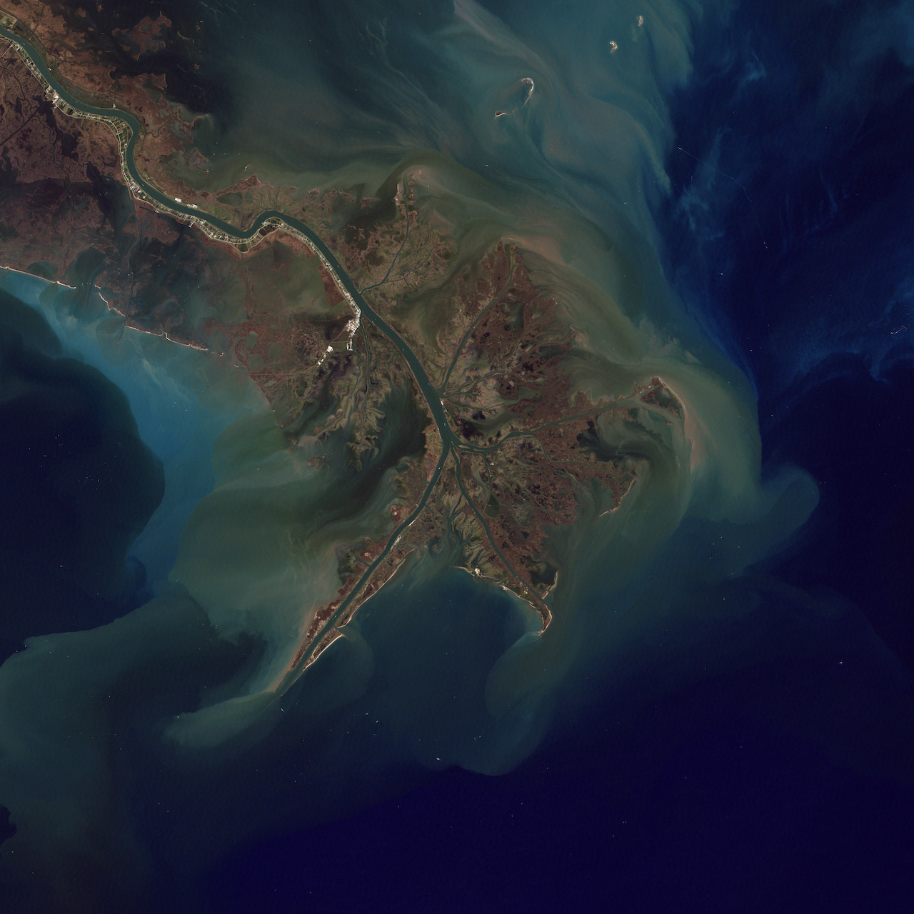
The Mississippi River draining into the Gulf of Mexico. (Photo courtesy of NASA’s Robert Simmon, based on Landsat data provided by the University of Maryland Global Land Cover Facility)
The question: How does nonseasonal river discharge influence regional sea level?
The answer: Nonseasonal variations in river discharge can have a significant effect on sea level near major river mouths.
A project by one group of researchers within the NASA Sea Level Change Team seeks to study these mechanisms, as reported in their paper earlier this year. Tony Lee, a co-author on the paper, says these processes involve a “halosteric effect,” where changes in the salinity, or “saltiness,” of seawater causes corresponding changes in sea level.
“River discharge brings in freshwater that dilutes the seawater, and fresher seawaters occupy more volume locally,” Lee said. “This effect increases the so-called halosteric height, which is one contributor to sea level change, in contrast to another contributor called thermosteric height that is related to thermal expansion of water.”
Extensive studies in the past show that seasonal river discharge can influence regional sea level significantly, Lee said. But the effect of discharge outside of this cycle, or nonseasonal discharge, around the global ocean has not been assessed systematically.
“From a sea level prediction perspective, we are more interested in the effect of nonseasonal discharge,” Lee said.
To study nonseasonal effects, Lee and his team conducted simulations using a global ocean computer model from the NASA-funded project “Estimating the Circulation and Climate of the Ocean” (ECCO). They ran two model simulations: control and sensitivity simulations.
In the control simulation, the model included daily river discharge and atmospheric forcings, or the effects of wind and surface buoyancy on sea level. In the sensitivity simulation, the daily river discharge was replaced by the average seasonal discharge, while atmospheric forcings were the same as in the control simulation.
Then the researchers compared the two simulations to assess the effects of the nonseasonal discharge, namely, the difference between the daily discharge and the average seasonal discharge.
“We found that nonseasonal discharge can affect sea level variations near major river mouths with a maximum impact up to 10 centimeters between low and high-discharge years,” Lee said. “These magnitudes are not small comparing to the average rate of global mean sea level rise [approximately 3.4 centimeters per decade].”
Why it’s important: The findings suggest that nonseasonal discharge should be considered in studying and predicting sea level variations near major river mouths. Extreme storms are expected to become more intense due to climate change, increasing the effects of nonseasonal discharge on regional sea level. The team will continue to incorporate nonseasonal discharge effects in their seasonal prediction of sea level variations along the Gulf Coast.
Previously, the team focused their sea level prediction efforts on the U.S. East and West coasts, only considering the effect of atmospheric forcings because the river discharge effect is much smaller in those regions.
“But when we look at the Gulf of Mexico, the same might not be true,” Lee said. “That is something that we are trying to assess: whether the inclusion of river discharge can improve seasonal prediction of sea level in the Gulf of Mexico.”