News | May 17, 2016
Ice-tracking satellite: the next generation
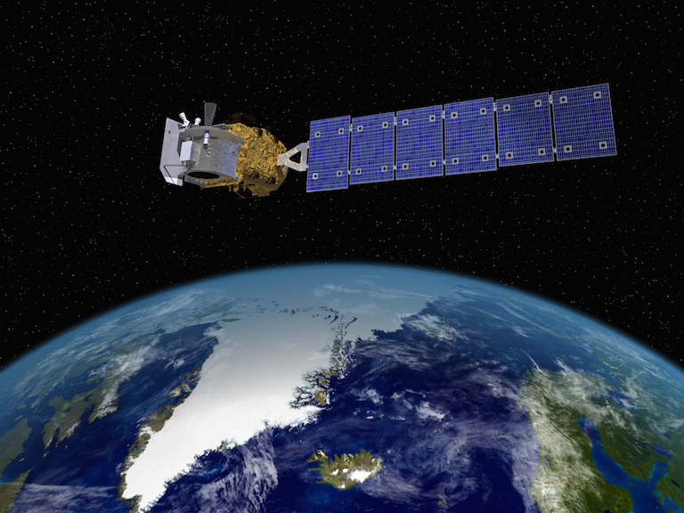
The expected launch of ICESat-2 in 2017 will continue NASA's decades-long effort to monitor changes in Earth's glaciers and great ice sheets.
Ice sheets and glaciers—Earth’s cryosphere—are a major focus for NASA’s Sea Level Change Team, and for team member Alex Gardner, a glacier specialist at the Jet Propulsion Laboratory in Pasadena. Gardner studies the effects of glaciers on sea level and on the planet’s water resources. During a break from a meeting at JPL on the soon-to-be-launched ICESat-2 (Ice, Cloud and land Elevation Satellite), Gardner answered a few questions from NASA’s Sea Level Portal.
Portal: What is the purpose of the ICESat-2 meeting?
Gardner: Each satellite has a science team. The team is supposed to guide the science mission. The satellite will launch next year; we’re now looking at what are the potential things we have to get sorted out before the satellite launches. Is the science quality going to be what we need? Does anything need to be changed before it goes up? How do we support the users? On a more “sciency” side, we are looking at how the laser (altimeter instrument on the spacecraft) interacts with the snow. More interesting is what ICESat-2 is.
Portal: And just what is it?
Gardner: ICESat-2 is a laser altimeter. The basic idea of a laser altimeter is that the satellite fires a laser pulse (light) that then passes through the atmosphere, bounces off the surface of the Earth, travels back through the atmosphere and is then received by the satellite. If you know exactly where the satellite is, where it’s pointing, how fast the laser energy (light) travels through the atmosphere, and how long it took the laser pulse to travel from the satellite to the surface and back then you will know exactly how far away the surface is from the satellite. The really amazing thing about ICESat-2 is, it’s a photon counting laser altimeter. That means that the detectors on the spacecraft are so sensitive that when a single photon finds its way back to the telescope, it records that event—every single photon it receives, the precise time and location.
What I keep telling people is, if you were standing in Boston and we put this satellite in New York and pointed it at you, we could tell whether you stepped off the curb or not. We’re close to being able to see if you mowed your lawn or not. It’s really incredible. We’re looking at centimeter precision—from space.
Portal: What are some of the questions you hope to answer with ICESat-2?
Gardner: If you use an altimeter to measure the volume of the Antarctic ice sheet, and how it changes, the really big question is how much are you losing to sea level rise. We don’t know that answer. If you have an error in your measurement of elevation change of one centimeter per year, it could double—or halve—the total signal. So you have to be able to resolve trends at the centimeter level. It has to be very, very precise.
ICESat-1 was a bit more conventional. It had a laser on it that did the same thing. It would send out a pulse and record the waveform coming back. But one of the big issues with ICESat-1 is that it didn’t directly measure the across-track slope. Imagine a sloping surface. Imagine you’re carrying a GPS and you walk in a straight line along a beach following the water’s edge, recording your elevation as you go. One year later you come back and try to walk the same transect to measure the change in surface height since you last visited, but you can only retrace your steps to within plus or minus 10 meters. Because you couldn’t retrace your steps exactly you won’t know if the elevation change you measure is because you were 10 meters higher up on the beach than the first time you visited or if the elevation of the sand had actually changed. We call this a problem of “unknown across-track slope.” With ICESat-2, we’ll have six beams, three strong, three weak, slightly offset from one another, to get the surface slope for the three beam-pairs. In addition we’ll get about nine times more coverage than we did with ICESat-1.
ICESat-2 will be also useful for sea ice. You have this floating surface always moving up and down, because of the tides and winds. What we measure is how thick the sea ice freeboard (the difference between ice height and sea surface height) is—how much is floating above the waterline. To do this, we try to measure the height of the water in the cracks between the ice and compare that to the height of the floating ice; this gives you the freeboard. When you have a surface as dynamic as the ocean, you can’t just go and measure the absolute elevation of the surface to figure how high it is above the water because you don’t know where the ocean lies. If you can see between the ice, you can find that surface. Sea ice has large implications for ocean circulation, ocean ecology and for global reflectivity (what scientists call the ‘albedo’).
Portal: It sounds like these elevation measurements are the key to understanding the effects of climate change.
Gardner: Elevation is so important to us that when ICESat-1 died in 2009, NASA started an airborne campaign, operation IceBridge, designed to keep collecting altimeter data in between the two missions. It’s likely to continue beyond that, but the community is looking forward to having the data from ICESat-2. Airborne missions simply cannot get the coverage you get with satellite missions, especially with places like Antarctica. Logistically it’s very difficult to try and cover a whole continent. IceBridge had to strategically select areas to monitor.
It all comes down to measuring the elevation very well, and even small uncertainties in elevation lead to large uncertainties in mass changes.
Portal: Have any major technical issues emerged during your meeting at JPL?
Gardner: We were a little bit concerned about the color of the laser, its green wavelength. It’s minor but it’s something we have to quantify: How much scattering of green light is there within the snow? It can affect the measurement of elevation. If you don’t know how it scatters, it’s difficult to say what is the best estimate of elevation. (But) the green laser is more stable and reflects more efficiently from the surface than ICESat-1’s near infrared laser. In many cases, in many applications, the color of the laser won’t be an issue at all. It’s just something we’re looking at.
Portal: Is ICESat-2 the most advanced laser altimeter ever launched?
Gardner: In glacier research there are four primary variables we measure from space, and they’re incredibly useful. One is gravity, one is elevation. The unique thing about those two is, they accumulate the signal. So if you have a change in the rate of ice loss or gain that happened 20 years ago, as long as you measured before the change occurred and after it occurred, it keeps the signal. Surface velocities and surface reflectance are the other ones that we measure. What’s unique about the altimeter integration signal (on ICESat-2) are the very fine spatial scales. GRACE might tell you the whole region is losing mass; ICESat can tell you where that mass has been lost. As for the big gap between the two missions (ICESat-1 and ICESat-2)—we can compare ICESat-1 elevations to ICESat-2 elevations to determine the accumulated change between the missions. The longer you wait, the larger the signal gets. If you keep doing it for another 20 to 30 years, you’ll know with a very high degree of certainty how the ice sheet has changed during that time. It also gives us the “where,” which also helps is understand the “how.” (ICESat-2 is) the most sophisticated by far.
View a video on the inner workings of the ICESat-2 laser altimeter
