News | February 7, 2023
Sea-Level Toolkit: New Guide Helps Planners Prepare
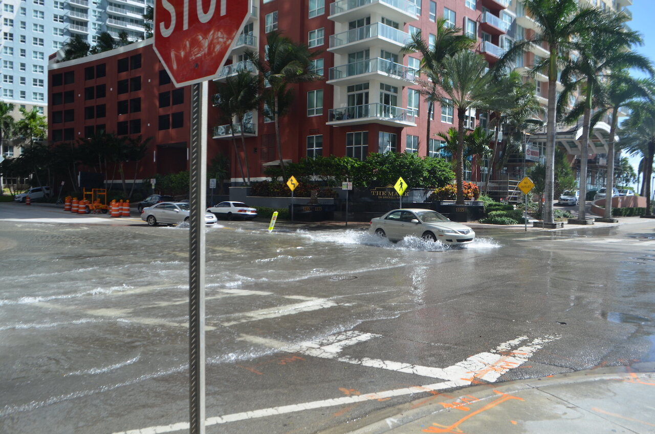
High-tide flooding, as seen here in Miami, is among the effects influenced by sea level rise that coastal managers must prepare for. Image credit: B137 (CC-BY)
Rising sea levels pose challenges for resource managers and planners in coastal regions around the country. These communities face threats such as the potential inundation of tidal wetlands, or damage to wastewater management systems and other infrastructure.
Planners working at the city or county level are tasked with redesigning, building, and protecting these valuable coastal assets. And they need tools and guidance to make wise choices.
Researchers, meanwhile, work to monitor and project sea level rise, flood regime shifts, and accompanying coastal changes. But their data and insights in the form of scientific presentations and technical reports might not answer basic questions for coastal planners. What’s the best way to determine local risk levels? How do we set priorities for preservation or engineering? Should coastal assets be designed to withstand the most likely scenarios for sea level rise, or those that are less likely but potentially far more damaging?
Get NASA's Sea Level Change News: Subscribe to the Newsletter »
To help coastal resource managers answer these questions, scientists have been working to make their findings more useful and accessible. A new roadmap for coastal planners, written by a geographically diverse team of extension, planning, and outreach professionals, offers a practical primer for communities preparing for rising seas.
The “Application Guide for the 2022 Sea Level Rise Technical Report,” released in June 2022, is an interpretive, practical complement to an interagency Technical Report on the latest sea level science. The work includes contributions from the NASA Sea Level Change Team working alongside federal agency partners.
The guide presents plain-language summaries of national sea-level-rise scenarios, observation-based extrapolations, and extreme water-level data presented in the Technical Report. It also offers data-driven and experience-based approaches to planning.
“This is intended to help people make sense of – and apply – the newest advancements in sea-level science,” said Renee Collini, lead author of the Application Guide and now director of the Gulf Center for Equitable Climate Resilience at The Water Institute.
“Seeing NASA’s recent science discoveries informing practical strategies to increase resilience and environmental equity of our nation is rewarding and inspiring,” said Nadya Vinogradova Shiffer, who directs the NASA Sea Level Change Team and the Ocean Physics program at NASA headquarters in Washington.
Clarity and collaboration
NASA Jet Propulsion Laboratory scientist Ben Hamlington co-led a collaboration among researchers from a variety of U.S. agencies and academic institutions to produce the technical report. He and other scientists on the NASA Sea Level Change Team then worked closely with Collini and others to translate key aspects of the report into less technical, more accessible language.
The mission of the Guide authors was “distilling the most pithy parts of the technical report into language vetted by the report authors, but also by people well-versed in science and risk communications,” said Jamie Carter, regional geospatial coordinator in the National Oceanic and Atmospheric Administration Office for Coastal Management. Carter turned much of the technical data into graphical visualizations, relying on his expertise in precision mapping of surface features, as well as in details of Earth’s surface features and ocean dynamics.
A central feature of the guide is to offer insight into how to make decisions without knowing exactly how much seas will rise. Planners know seas are rising, but cannot be sure of the precise magnitude.
One method is the “risk tolerance approach.” It begins with determining how critical a given asset is to a coastal community – for instance, a wastewater treatment plant considered vital to the community for at least the next half century. The difficulty of adapting such a facility to sea-level rise, or relocating it, leads to an assessment of “low risk tolerance.” That, in turn, means such a plant probably should be designed for “intermediate-high” or “high” sea-level-rise scenarios. While less likely, these scenarios have potentially severe effects, so the plant’s designers might consider it wise to incorporate them into their long-range planning.
At the other end of the spectrum are assets with a high risk tolerance – a dock, or a shed, for example, that is not expected to have a long lifespan and is not “super critical” to the community, Collini said.
She draws an example from her own experience in home renovation.
“I like to use my house – buying a house a few years ago,” she said. “It was very expensive to me, very important to me, but not critical to the whole community.”
In deciding what kind of flood risk to consider when choosing a home, Collini looked at changes in storm surge and high tide under an “intermediate” scenario. That meant adding some protection from sea-level rise, but not moving away from family and friends on the coast to avoid highly damaging but unlikely outcomes.
Such approaches to decision-making in the face of uncertainty provide planners with a bridge from the scientific language of peer-reviewed journals to the nuts and bolts of preparing for a changing coast.
“We should be providing support to those that do go that last mile,” Hamlington said. “We want our science to be useful, and we understand that we need to work closely with and support the experts that can help us do that. The technical report and Application Guide are great examples of that process.”
