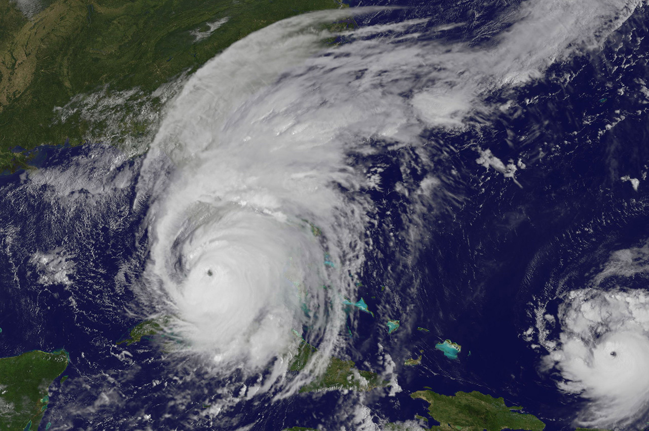
As Hurricane Irma approached southern Florida, a NASA satellite captured a night-time image of the storm in the Florida Straits and identified where the strongest storms were occurring within Irma's structure. NOAA's GOES satellite provided a visible image at the time of Irma's landfall in the Florida Keys (above).
As Irma moved along the coast of Cuba, the storm weakened to a Category 3 Hurricane on the Saffir-Simpson Hurricane Wind Scale. After moving away from the northern coast of Cuba, Irma passed over waters that are warmer than 30 degrees Celsius (86 degrees Fahrenheit). Those warm waters enabled the storm to re-strengthen from a Category 3 hurricane to a Category 4 hurricane.
On Sept. 10, at 3:38 a.m. EDT (0738 UTC) the Visible Infrared Imaging Radiometer Suite (VIIRS) instrument aboard NASA-NOAA's Suomi NPP satellite captured an infrared view of Irma at night as it moved north from the northern coast of Cuba toward the Florida Keys. The image revealed that Irma's eye had become clear again. The image also showed the city lights in the southeastern U.S.
VIIRS also showed temperatures of Irma's cloud tops to indicate where the strongest part of the hurricane is located. The coldest cloud top temperatures indicate the strongest storms. The VIIRS image showed the well-defined eye of Irma with strong thunderstorms around the eye which is indicative of an intense tropical system. Strongest thunderstorms with coldest cloud tops were as cold as 190.1 Kelvin (minus 83 degrees Celsius/minus 117.4 degrees Fahrenheit).
At 9:10 a.m. EDT on Sept. 10, Irma made landfall at Cudjoe Key in lower Florida Keys.
Fifteen minutes later NOAA's GOES East satellite captured an image when Irma's eye was moving over Cudjoe Key, and toward Florida's southwestern coast. Irma had re-strengthened into a Category 4 hurricane and the GOES satellite image showed that the eye became clear again.
Warnings and watches in effect on Sunday, September 10
A Storm Surge Warning is in effect for south Santee River southward to Jupiter Inlet, north Miami Beach southward around the Florida peninsula to the Ochlockonee River, the Florida Keys and Tampa Bay.
A Hurricane Warning is in effect from Fernandina Beach southward around the Florida peninsula to Indian Pass, the Florida Keys, Lake Okeechobee, Florida Bay and the Cuban provinces of Matanzas and La Habana. A Hurricane Watch is in effect from north of Fernandina Beach to Edisto Beach.
A Tropical Storm Warning is in effect from west of Indian Pass to the Okaloosa/Walton County Line and north of Fernandina Beach to South Santee River. A Tropical Storm Watch is in effect for Bimini and Grand Bahama.
Hurricane Irma at 8 a.m. EDT on Sunday, September 10
At 8 a.m. EDT (1200 UTC) on Sept. 10 the center of Hurricane Irma was located about 20 miles (30 km) east-southeast of Key West, Florida near 24.5 degrees north latitude and 81.5 degrees west longitude.
The National Hurricane Center said "Irma is moving toward the north-northwest near 8 mph (13 kph), and an increase in forward speed is expected later today, with that motion continuing through Monday, Sept. 11.
Maximum sustained winds are near 130 mph (215 kph) with higher gusts. Irma is a category 4 hurricane on the Saffir-Simpson Hurricane Wind Scale. Hurricane-force winds extend outward up to 80 miles (130 km) from the center and tropical-storm-force winds extend outward up to 220 miles (350 km). The estimated minimum central pressure is 929 millibars.
For updates on Irma and effects of wind, storm surge and rainfall, visit the National Hurricane Center website: www.nhc.noaa.gov.
